Severe Thunderstorm Issued for North Texas: What You Need to Know
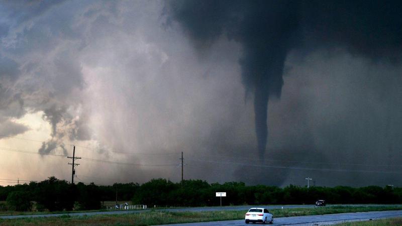
The National Weather Service has issued a Severe Thunderstorm Watch for most of North Texas and parts of Central Texas until 8:00 a.m. this morning. A strong system along a warm front is bringing the potential for very large hail, damaging winds, and a low-end tornado risk in areas close to the front.
Hail, wind, and tornadoes are the main concerns with this severe weather event. While egg-sized hail is possible in isolated areas, most locations will see smaller hail or no hail at all. Wind gusts may reach up to 60 miles per hour, capable of causing localized damage. The tornado risk is very low, mainly confined to spots right along the warm front.
The timeline for the storm activity varies based on location. The western DFW Metroplex can expect peak storm activity from 2 a.m. to 8 a.m., while the eastern DFW Metroplex will have higher chances from 4 a.m. to 10 a.m. Areas south and southeast of DFW are likely out of the path of the most intense storms.
After the storms clear, cooler air and northern winds will dominate the day. Patchy rain is possible west and northwest of DFW during the afternoon and evening. Sunday will be dry but chilly, with wind chills in the 30s early on and highs stuck in the 50s, well below the seasonal average of 75°F.
To stay safe during severe weather, it is important to stay indoors, charge mobile devices, keep alerts on, and park vehicles in sheltered areas if possible. It is also crucial to stay tuned to local news and weather updates for the latest information on the storm.
Title: Severe Thunderstorm Issued for North Texas: What You Need to Know

 Joyful
0%
Joyful
0%
 Cool
0%
Cool
0%
 Thrilled
0%
Thrilled
0%
 Upset
0%
Upset
0%
 Unhappy
0%
Unhappy
0%